


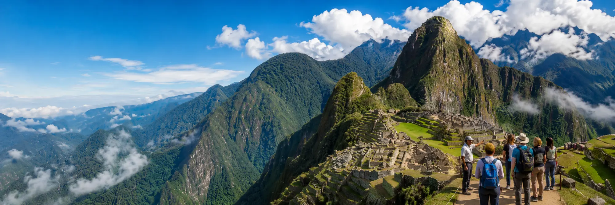
As of June 1, 2024, through Ministerial Resolution 528-2023-MC from Peru's Ministry of Culture, 3 new circuits came into effect, grouping 10 official routes inside the Historic Sanctuary of Machu Picchu.
Machu Picchu Circuits
Maps of the 3 official circuits
Click any circuit to view the full map.
Panoramic
- 1-A Machupicchu Mountain
- 1-B Upper Terrace
- 1-C Intipunku
- 1-D Inka Bridge
Classic Machupicchu
- 2-A Complete Classic Circuit
- 2-B Lower Terrace
Royal Machupicchu
- 3-A Waynapicchu
- 3-B Designed Royalty
- 3-C Great Cavern
- 3-D Huchuypicchu
Circuit 1 - Panoramic
High viewpoints and connection with nature · 4 available routes
Route 1-A: Machupicchu Mountain
Combines exploration of the Inca citadel with a hike to Machupicchu Mountain (about 3,082 m / 10,112 ft), offering unique panoramic views. Ideal for travelers who want adventure and archaeology in one day.
- Duration
- 4-6 hours (citadel + ascent)
- Difficulty
- Moderate-High · stone stairs with significant elevation gain
- Maximum altitude
- 3,082 m / 10,112 ft at the summit
- Availability
- Year-round · additional ticket required
- Highlights
- Temple of the Sun, Main Plaza, Guardhouse and high viewpoints
- Recommended gear
- Trekking shoes, water, sunscreen and permitted poles
Who is it ideal for?
- Trekkers and active travelers - A demanding climb with panoramic reward.
- Photographers - Wide views of the sanctuary and the Urubamba Valley.
- Second-time visitors - A strong option if you already know the classic route.
Route 1-B: Upper Terrace
The shortest and most accessible route in Circuit 1. It reaches the upper terraces and gives you the postcard photo from the Guardhouse sector.
- Duration
- 2-3 hours
- Difficulty
- Low
- Highlights
- Guardhouse, agricultural terraces and classic postcard view
- Availability
- Year-round
Who is it ideal for?
- Families - Lower physical demand and a more direct route.
- Travelers with limited time - Prioritizes the main panoramic view.
- Photographers - Access to Machu Picchu's most recognizable angles.
Route 1-C: Intipunku Gate
High season only · April-OctoberA hike to Intipunku, the Sun Gate and former entrance of the Inca Trail. It requires moderate fitness due to stone paths and stairs.
- Duration
- 3-4 hours
- Hike
- 1-1.5 additional hours
- Difficulty
- Moderate
- Availability
- High season only
Who is it ideal for?
- Hikers - A historic route with progressive views of the sanctuary.
- Inca Trail enthusiasts - Connects with the original ceremonial entrance.
- Landscape photography - Different perspectives from the upper sector.
Route 1-D: Inka Bridge
High season only · April-OctoberRoute to the ancient Inka Bridge, with a narrow trail near cliffs. It is attractive for explorers but requires caution, especially with rain or fog.
- Duration
- 3-4 hours
- Hike
- 1-1.5 additional hours
- Difficulty
- Moderate
- Note
- Avoid during heavy rain or if you have vertigo
Who is it ideal for?
- Explorers - A less conventional route inside the sanctuary.
- Inca history - Shows defensive and territorial control solutions.
- Careful travelers - Requires attention on narrow sections.
Circuit 2 - Classic Machupicchu
The recommended route for first-time visitors · 2 available routes
Route 2-A: Complete Classic Circuit
The most extensive and detailed route. It combines agricultural, urban and religious areas, offering the most complete archaeological experience for a first visit.
- Duration
- 2.5-3.5 hours
- Difficulty
- Moderate
- Includes
- Classic photo, plazas, temples and main urban sectors
- Recommended for
- First visit to Machu Picchu
Who is it ideal for?
- First trip - The most balanced option for discovering the citadel.
- Culture-focused travelers - Allows a complete archaeological reading.
- Active families - A complete route with moderate effort.
Route 2-B: Lower Terrace
A classic variant that crosses lower agricultural terraces and main ceremonial areas. It is less extensive than 2-A but still offers a broad experience.
- Duration
- 2-3 hours
- Difficulty
- Moderate
- Route
- Urban, agricultural and ceremonial areas
- Ideal
- History and photography at a more compact pace
Who is it ideal for?
- First-time visitors - A good alternative if Route 2-A is unavailable.
- Photography - Keeps broad views and representative sectors.
- Moderate pace - Less extensive without losing historical context.
Circuit 3 - Royal Machupicchu
Lower sectors, ceremonial areas and mountains · 4 available routes
Route 3-A: Waynapicchu Mountain
The most famous and challenging ascent. Waynapicchu reaches about 2,693 m / 8,835 ft and offers one of the sanctuary's most iconic views. Not recommended for vertigo or limited mobility.
- Duration
- 4-6 hours
- Ascent
- 1-1.5 hours
- Difficulty
- High
- Capacity
- 400 visitors per day in morning entry times
Who is it ideal for?
- Intense adventure - A steep and highly demanded ascent.
- Travelers without vertigo - There are narrow and exposed sections.
- Advance bookings - Tickets usually sell out quickly.
Route 3-B: Designed Royalty
Visits ceremonial and residential areas without a mountain ascent. It is a quieter alternative within Circuit 3, focused on architecture and spirituality.
- Duration
- 2.5-3.5 hours
- Difficulty
- Moderate
- Focus
- Architecture, rituality and Inca residence
- Ideal
- Families and culture-focused travelers
Who is it ideal for?
- Inca culture - Prioritizes ceremonial and residential sectors.
- Families - Less demanding than the mountain routes.
- Contemplative travelers - A calmer route through lower sectors.
Route 3-C: Great Cavern
High season only · April-OctoberRoute to a place of worship linked to the earth and mountains. It is less crowded, with vegetation trails, narrow sections and a more exploratory feel.
- Duration
- 4-5 hours
- Hike
- 1.5-2 additional hours
- Difficulty
- Moderate
- Availability
- High season only
Who is it ideal for?
- Adventurers - Discover lesser-known places in the sanctuary.
- Inca spirituality - A worship site related to the earth and mountains.
- Photographers - Unique and less repeated images.
Route 3-D: Huchuypicchu
High season only · April-OctoberCombines the citadel with the ascent to Huchuypicchu, the small mountain at 2,497 m / 8,192 ft. It is less demanding than Waynapicchu and has limited capacity.
- Duration
- 3-4 hours
- Ascent
- 1-1.5 hours
- Difficulty
- Moderate
- Capacity
- 200 visitors per day
Who is it ideal for?
- Alternative to Waynapicchu - A shorter and calmer hike.
- Photographers - Unique views without such high demand.
- Active travelers - A good balance between hiking and archaeological areas.
Quick comparison
| Detail | Circuit 1 | Circuit 2 | Circuit 3 |
|---|---|---|---|
| Classic postcard photo | Yes, from upper viewpoint | Yes, the most traditional | Not from the classic angle |
| Temple of the Sun | No | Yes | Yes |
| Intihuatana | No | Yes | No |
| House of the Inca | No | No | Yes |
| Physical effort | Variable | Moderate | Low to high |
| Best for | Photos and views | First visit | Lower sectors and mountains |
Booking recommendations
Book in advance
Circuit 2, Waynapicchu and Huchuypicchu often sell out quickly during high season.
Choose by experience
Your ticket defines which sectors you will visit. Inside the sanctuary, you cannot switch circuits.
No re-entry
Once you leave your assigned circuit, you cannot enter again.
Not sure which ticket to buy?
At Dreamy Tours, we review availability, train schedules, buses, hikes and traveler profile to recommend the right circuit.
Request Machu Picchu advice