Wayllabamba comes from the Quechua word “grassy plain”, this site is about 2750m above sea level. Wayllabamba in Peru is generally where people spend the first night of camping. Only one village is inhabited. On the way there are small stalls to buy what you need. The site itself is very pretty, with scattered houses, terraces, an old aqueduct and canals.
This small group of huts is located at the confluence of the Cusichaca river and the Llullucha stream (or Hatun Wayruro). Some of the huts in Wayllabamba Peru are built on the foundations of Inca buildings, and there are sections of ancient aqueducts, still in use today.
At the base of the mountain on the opposite side of the Llullucha stream are the ancient tombs and the remains of a path near them.
After these, there are remains of some terraces in very bad condition. The Inca trails through this point were important, one continues continuous to the Wayllabamba Peru river (this point is also called Cusichaca) and ascends to the Nevado Salqantay, a sacred mountain covered with snow.
Others continue up the Llullucha stream to the canyon and ascend to the Warmiwañusqa pass that continues towards Machu Picchu. This is the walkers’ route.
Climate and Altitude in Wayllabamba Peru
Wayllabamba 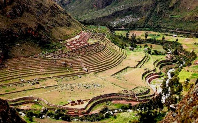
Wayllabamba
Huayllabamba Cusco altitude: 3000 m
Weather in Huayllabamba Cusco: cold, -10 degrees to 15 degrees.
Inca Trail through Wayllabamba
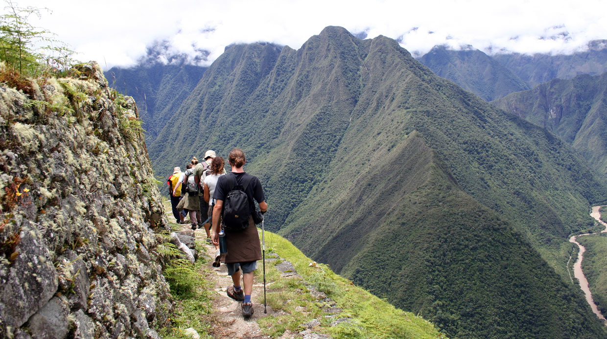
At km 82 of the Cusco railway, in the village of Aguas Calientes–MachuPicchu pueblo, the Inca Trail begins, considered one of the most attractive routes in Peru, passing through Wayllabamba Peru. This course is also recognized as a royal road dedicated to the Inca nobility.
This 43 km Inca Trail through Wayllabamba Camp, requires some physical strength, leads to the Inca city of Machu Picchu. Granite paved road along which are buildings designed for different activities (residential, meditation, worship), as well as temples, factories and warehouses.
The incredible variation in climate, the spectacular views of valleys and mountains, the sky and sudden weather phenomena, make this course an experience in which each man realizes his own humility. Later, silhouetted against the sky as calm as a cultural kingdom fully integrated with that of nature, magic and the unforgettable view of Machu Picchu.
How to get to Wayllabamba Camp?
The only way to get to Wayllabamba Peru is through the Inca Trail 4 days / 3 nights.
Walking the Inca Trail to Machu Picchu in Peru is the greatest trekking adventure in South America. And classified as one of the three best treks in the world.
The trail begins at an altitude of approximately 2,800 meters above sea level from Km 82 / Piscacucho and crosses the Andes, crossing exciting places such as the “Paso de la Mujer Muerta” which, at 4,200 meters above sea level, is the highest point of the trek. Some other impressive Inca sites await you like Wiñayhuayna or “Forever Young” before descending towards the always fascinating Machu Picchu (2,450 m).
It takes four days to reach the legendary Inca city and, with the exception of the Dead Woman Pass, reaching Machu Picchu is not too demanding.
The Inca Trail is famous for its spectacular Andean landscape, full of snow-capped mountains between June and October, as well as the captivating Inca ruins that you could find along the way.
Our professional tour guides bring the history of Peru to life as we follow in the footsteps of the Incas in the company of their modern descendants, our porters from the Sacred Valley.
The Altitudes of the Inca Trail begin in an area called «Quechua»: this area is between 2300 – 3500 m (7,500-11,500 feet) and its climate is temperate and dry with temperatures ranging between 0 -21C (32 -70F). The rainy season is from December to March. The rest of the year is dry or even dry from May to September. This region is widely cultivated and essentially no natural plants remain.
Above Wayllabamba Camp, there is the area called «Suni» or «Jalca»: this is the area between 3500 – 4000 m (11,500 – 13,000 feet). There is still some agriculture possible at this altitude. Above that is the «Puna», which is a zone of 4000 – 4800 m (13,000 – 15,750 feet). Its climate is very cold with frequent frosts. It is mainly grasslands with a type of grass called “Ichu” and the area is used to graze camelids such as Llamas and Alpacas.
In case the tickets for the Inca trail are sold out, there are some alternative routes such as the Salkantay Trek 5 days / 4 nights or the Choquequirao Tour 4 days / 3 nights..