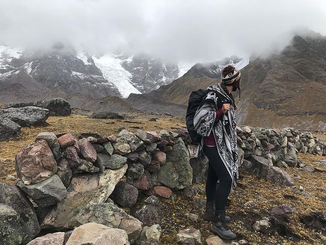
Ausangate Trek 5 Days, A minimum of 02 people is required for the group tour in Ausangate. A walk through the Cordillera do Vilcanota that literally “breathes deeply”, on a route called “Caminho del Apu Ausangate (6398 masl)”, near the highest sacred mountain in the Cusco region. The “Apu” is the carrier of life and the guardian of one of the most primitive ecosystems in the world. ausangate
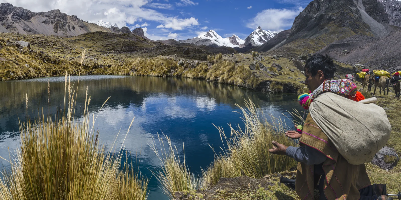
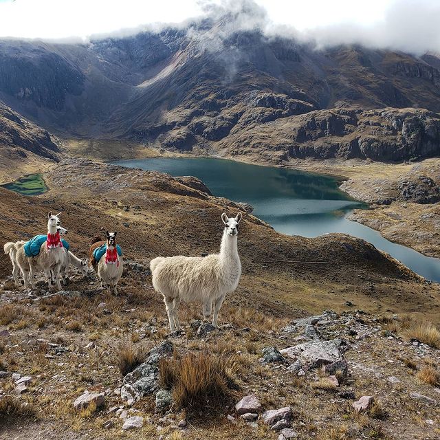
The shepherds of the community of Chillca are the owners of the llamas and horses that will accompany us on our walk and, at the same time, will carry our luggage and logistics equipment. They will proudly share with us their land and inspiring world.
On some nights, they sing their authentic traditional music, which is performed in the “tambos” by members of the community. ausangate rainbow mountain, ausangate rainbow mountains.
Summary
Day 1: Cusco – Tinqui – Upis
- Transportation from Cusco to the village of Tinqui (3,900 meters / 12,795 feet above sea level).
- Observe Andean communities and camelids (llamas and alpacas).
- Camp in Upis (4,400 meters / 14,435 feet).
- Duration: 3 hours drive + 6 hours hike.
Day 2: Upis – Ausangate Q’ocha Lake
- Ascent to Arapa Pass (4,800 meters / 15,748 feet).
- Stop by Yana Cocha Lake for a picnic lunch.
- Ascent to Ausangate Pass (4,850 meters / 15,912 feet).
- Camp at Ausangate Q’ocha Lake (4,650 meters / 15,256 feet).
- Duration: 7 hours hike.
Day 3: Ausangate Lake – Palomani Pass – Jampa
- Ascent to the highest point, Palomani Pass (5,200 meters / 17,060 feet).
- Spectacular views of the Ausangate glaciers.
- Descent into the Finaya Pampa Valley.
- Camp in Jampa (4,700 meters / 15,420 feet).
- Duration: 8 hours hike.
Day 4: Jampa – Campa Pass – Pacchanta
- Ascent to Campa Pass (5,100 meters / 16,732 feet).
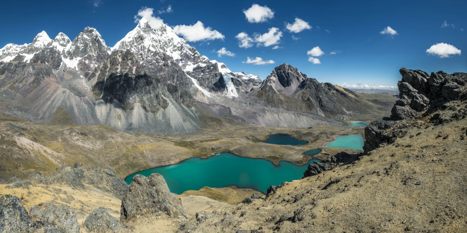
- Hike past numerous mountain lakes.
- Camp in Pacchanta (4,350 meters / 14,271 feet).
- Enjoy the natural hot springs and a traditional dinner.
- Duration: 6 hours hike.
Day 5: Pacchanta – Tinqui – Cusco
- Descend on foot to the village of Tinqui.
- Transportation from Tinqui back to the city of Cusco.
- Duration: 3 hours hike.
Itinerary
Day 1: Cusco – Urcos – Tinqui – Upis
At 05:30, we take our vehicle to the city of Tinqui. Along the way, we will observe small communities (each with its own customs and traditions). Tinqui (3,900 m.s.m.), is where our team of transporters awaits us to begin the walk.
On the way, we have the possibility to visit some Andean families and observe the camelids (llamas and alpacas) at more than 4,000 m.s.s.l. High. Upis (4,400 m.s.m.) is the site of our camp. The climate is cold in this area.
The transportation time is 03h00min Hrs. Walking time is 06:00 Hrs. Approximately.
Day 2: Upis – Pas Arapa – Yana Cocha – Extreme Step Ausangate – Laguna Ausangate
After breakfast, we start a climb in the morning to the first pass known as Arapa (4,800 m.a.s.l.), then the depth of the Yana cocha (4,500 m.s.n.m), where we have our picnic.
We continue the ascent to the Pass called Ausangate End (4,850 m.s.m.) and finally we reach the edge of Ausangate (4650 m.s.m.), it is the site of our camp. The climate is cold in this area. The walking time is 07h00min hrs. about.
Day 3: Laguna Ausangate – Paso Palomani – Jampa
It is the most arduous and, at the same time, the most beautiful and beautiful for the ascent to the highest step of this expedition; Palomani (5,200 m.s.m.), where the view is so close to the mountains and glaciers of Ausangate. We descend to the valley of the pampas of Finaya and our camp will be in Jampa (4,700 m.s.m.). The walking time is 08h00min hrs. about.
Day 4: Jampa – Campa Paso – Pacchanta
The other imposing presence of the climb is the Campa pass (5,100 m.s.m.) then, between numerous lagoons, we go to Pacchanta (4,350 m.s.m.), the night of our camp will be at. Pachanta is where we take thermal baths and enjoy a great dinner typical of the region. The walking time is approximately 06h00min Hrs.
Day 5: Pacchanta – Tinqui – Cusco
After breakfast, we start the walk to the city of Tinqui (0.3850 m.s.m.), where we take our transport to the city of Cusco (3.350 m.s.m.). The walking time is 03h00min Hrs. Approximately. ausangate trek, tallest mountain in peru.
Included
Tour Includes
- Hotel transport to the city of Tinqui
- Transportation from Tinqui to Cusco
- Entrance to Ausangate Park
- Professional guide English / Spanish (request language)
- High quality camping equipment (professional tent, Doite Top 4 model, extra light / 4.5 kg wide for 2 passengers. Mats, dining tent with table and chairs, sanitary tent)
- Meals during the tour (breakfast, lunch, dinner and snacks / vegetarian option)
- Kitchen and cooking equipment
- Horses and mules, for all our staff and camping equipment
- Emergency horse
- First aid kit and oxygen bottle
Tour Does not Include
- Breakfast on the 1st day
- Sleeping bag (if you don’t have this, we offer you)
Contact Us
General Conditions
- All rates are in US dollars (optional for currency exchange) and are programmed per person.
- The rates valid for Peruvians only include VAT.
- All our rates are subject to availability and changes.
- Children under 02 years and 11 months are considered INF (babies), do not pay any service and do not have the right to food, bed or seat on the tours.
- DCC (child) is considered a child from 03 to 10 years and 11 months, has a special rate and shares a room with parents.
- Children over 11 years old considered adults.
- Minors must travel with an identity document.
- Rates do not apply to holidays, Easter, long weekends, national holidays, Christmas or New Years.
More Information
What is the 5-Day Ausangate Trek and What Does It Include?
The 5-Day Ausangate Trek is one of the most impressive adventures in southern Peru. It lasts exactly 5 days and 4 nights, circumnavigating the Ausangate mountain, the most sacred apu (mountain spirit) of Cusco. It includes transportation from your hotel in Cusco to Tinqui, a bilingual guide, all meals, camping equipment (tents, sleeping pads), a kitchen crew, mules, community entrance fees, access to hot springs, and return to Cusco. It’s a complete journey that combines extreme nature, Andean culture, and spirituality.
What Makes the Ausangate Trek Different from Other Treks?
The Ausangate Trek is unique because it doesn’t follow a mass tourism trail. Instead, it passes through territories managed directly by Andean communities. Unlike the Inca Trail or Salkantay, here you pay small contributions (10 soles) to each community for passage, campsites, and services. This makes the trek a real community-based tourism experience, where your trip helps families in remote areas maintain their traditions and lands.
Where Does the Ausangate Trek Start?
The Ausangate Trek starts in the village of Tinqui, about 3 hours from Cusco. We depart very early, at 5:30 a.m., to arrive before noon. During the journey, you’ll see small communities with their own customs. Tinqui is at 3,900 meters above sea level, surrounded by grasslands and mountains. From there, the official hike to Upis, the first campsite, begins.
What Do You Do on the 5-Day Ausangate Trek?
On the 5-Day Ausangate Trek, you hike through extreme landscapes: high valleys, colorful lagoons, glaciers, and mountain passes. Each day has a goal: climbing Arapa Pass, visiting Yana Cocha Lagoon, ascending to Palomani Pass (5,200 masl), descending through Pampa Finaya, relaxing in the hot springs of Pacchanta, and finally returning to Tinqui. It’s a demanding pace but highly rewarding, with everything organized by your agency.
What Will I See on the Ausangate Trek in Peru?
On the Ausangate Trek in Peru, you’ll see some of the country’s most spectacular landscapes: turquoise lagoons like Yana Cocha, glaciers of the Ausangate mountain, red valleys like Pampa Finaya, high passes like Palomani and Arapa, and natural hot springs in Pacchanta. You’ll also visit communities like Upis, Jampa, and Chillca, where families live from livestock and community-based tourism. It’s a real connection with the Andes.
What Is the Ausangate Lagoon and Where Is It Located?
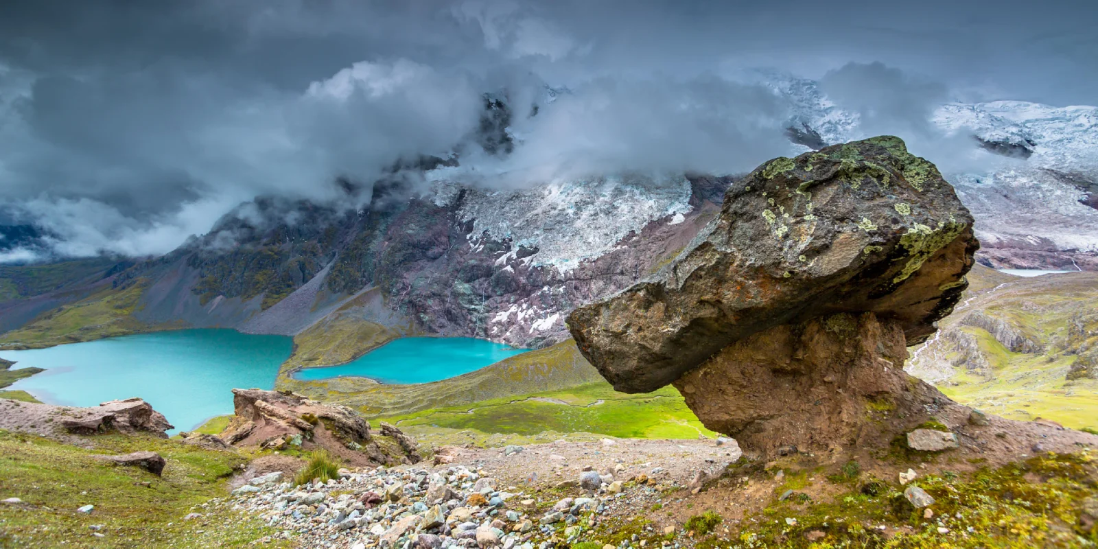
The Ausangate Lagoon is one of the many colorful lagoons you’ll see during the trek. It’s located near Arapa Pass or in areas like Yana Cocha. It has turquoise, green, and dark blue tones, depending on the light and minerals in the soil. Many travelers stop here for photos and offerings out of respect for the apu. It’s a magical and spiritual place, ideal for connecting with the energy of the area.
What Is Palomani Pass and How High Is It?
Palomani Pass is the highest point of the trek, at 5,200 meters above sea level. It’s the most challenging part of the journey, with cold, wind, and a long ascent. But it’s also the most beautiful: from here, you see the Ausangate mountain face-to-face, glaciers shining, and the landscape opening up to pristine valleys. Many rest here, take photos, and continue descending with renewed energy.
What Are the Pacchanta Hot Springs?
The Pacchanta Hot Springs are natural hot water springs that flow from the mountain. They’re located in the community of Pacchanta, near the end of the trek. The water comes from volcanic sources and helps relax muscles after days of hiking. Access costs 10 soles and is a very comforting experience, especially at night after a typical regional dinner.
What Is Tinqui and Why Does the Trek Start There?
Tinqui is a small town in the Canchis province, the traditional starting point of the trek. It’s at 3,900 meters, with a cold climate and grassland landscapes. From here, the hike to Upis begins. It’s a peaceful place where families raise alpacas and llamas. Most tours depart from here because it’s accessible by road from Cusco and marks the symbolic start of the journey.
What Is the Upis Campsite Like?
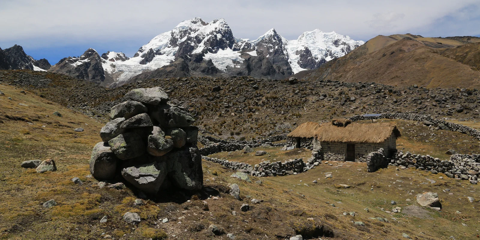
The Upis Campsite is at 4,400 meters, in a valley surrounded by mountains. It has eco-toilets, cooking areas, and space for tents. The Upis community keeps it clean and safe. You spend the first night here after 6 hours of hiking. It’s ideal for resting, hydrating, and mentally preparing for the days ahead.
What Will I See in Jampa?
Jampa is an intermediate campsite at 4,700 meters. It’s in a green valley with good access to water and pastures. Here, you can see families who live from livestock and small farms. It doesn’t have advanced tourist services but is part of the trek’s historical route. It’s a good place to rest before the final stretch.
What Is Arapa Pass?
Arapa Pass is one of the first high passes of the trek, at 4,800 meters. It’s a challenging climb but with spectacular views of the Ausangate mountain. From here, you begin descending toward Yana Cocha. It’s a great spot for photos, deep breaths, and feeling connected to the mountain.
What Is Pampa Finaya?
Pampa Finaya is a wide, green valley you pass through on the third day. It’s right after Palomani Pass. Here, the landscape changes from snow to grasslands. It’s an ideal place to rest, see camelids, and enjoy the tranquility. Many travelers consider it one of the most beautiful points of the trek.
What Is the Climate Like on the Ausangate Trek?
The climate on the Ausangate Trek is extreme and changes quickly. Mornings are very cold (-5 °C), midday can be sunny and warm, and nights are cold again. During the rainy season (November to April), there are afternoon showers. From May to October, it’s drier. Bring layered clothing, waterproof gear, and warm clothes.
What Are Some Useful Tips for the Ausangate Trek?
Some useful tips for the Ausangate Trek are: acclimatize for 2 days in Cusco, drink plenty of water, wear well-broken-in shoes, avoid carrying a heavy backpack, respect offerings, and do not leave trash. It’s also helpful to bring snacks, toilet paper, and a flashlight. And above all: enjoy every step, because this trek is a real connection with the Andes.
What does “Apu Ausangate” mean and why is it important?
“Apu Ausangate” is the name local communities give to the Ausangate mountain, considering it a spiritual being that protects the region. In the Andean worldview, apus are guardians of the land, water, and people. Many guides make a small offering before crossing high passes as a sign of respect and gratitude. It is a way to honor the local culture.
What is the Vilcanota mountain range and where is it located?
The Vilcanota mountain range is a mountain chain in southern Peru, between Cusco and Puno. It is the second highest in the country and home to the Ausangate mountain (6,384 masl). Within it are the Ausangate trek, lagoons like Yana Cocha, and valleys like Pampa Finaya. It is an area of great natural beauty and Andean spirituality, ideal for those seeking authenticity.
How difficult is the Ausangate Trek?
The difficulty of the Ausangate Trek is high. There are steep climbs, such as Palomani Pass (5,200 masl), and you walk between 6 and 8 hours daily. The altitude affects many, especially at the beginning. But if you are acclimatized in Cusco, go slowly, and stay hydrated, you can complete it. You don’t need to be an athlete, but you should be in good physical condition. The most important thing is to go at your own pace.
What is the best time for Ausangate?
The best time for Ausangate is from May to October, the dry season. During these months, there is less rain, clear days, and better conditions for hiking. This is when most tourists go, so you should book in advance. From November to April, there is more rainfall, especially in the afternoon, but the landscape is greener and there are fewer people.
What will I see on the Ausangate Trek itinerary?
On the Ausangate Trek itinerary, you will see a unique combination of nature and culture: colorful lagoons, glaciers, red valleys, hot springs, Andean communities, and animals like vicuñas and condors. Each day offers something new: challenging climbs, relaxing descents, traditional villages, and landscapes that seem otherworldly. It is a visually stunning journey.
What should I pack for the Ausangate Trek?
For the Ausangate Trek, you should pack: thermal clothing, a waterproof jacket, a fleece, trekking pants, good broken-in shoes, a 30-40L backpack, a hat, sunscreen, a flashlight, water (1.5–2 liters), snacks, and documents. We also recommend trekking poles, a sleeping bag (some agencies rent them), and a camera. Everything else is included in the tour.
Where can I see the Ausangate Trek map?
You can see the Ausangate Trek map on the tour’s website or when booking. It shows each stage: Tinqui, Upis, Jampa, Palomani Pass, Yana Cocha, Pacchanta. Your guide will also provide it. It is useful for understanding the elevation, altitudes, and planning your pace. It will help you know what to expect each day.
Can I do Ausangate without a guide?
It is not recommended to do Ausangate without a guide. Although no official permit is required, the trail is not always marked, there are risky areas, and there is no cell signal. If you go alone, you must bring a GPS, map, food, tents, and emergency equipment. Most prefer to go with an agency for safety, support, and comfort.
What does the 4-Day Ausangate offer?
The 4-Day Ausangate is a shortened version of the trek. It lasts 4 days and 3 nights, with fewer campsites and a more intense pace. Ideal for those with limited time who don’t want to miss the essence of the trek. Some omit certain lagoons or shorten the route, but they still offer incredible landscapes and contact with communities.
What will I see on the Ausangate glaciers?
On the Ausangate glaciers, you will see ancient ice shining under the sun, with deep cracks and bluish reflections. They are at the summit of the Ausangate mountain, though you do not climb them. From high passes like Palomani or Arapa, you see them up close, imposing and majestic. They are evidence of climate change, as they have receded significantly in recent decades.
What animals will I see among the Ausangate camelids?
Among the Ausangate camelids, you will see llamas, alpacas, and sheep grazing in the fields. You may also spot wild vicuñas, especially in high areas. Some communities raise these alpacas for their wool. It is common to see them near the trails, and children often tend to them. It is part of the trek’s charm.
What are the Ausangate hot springs?
The Ausangate hot springs are natural hot water pools that flow from the mountain. They are in Pacchanta or near other points along the route. The water comes from volcanic sources and helps relax muscles after days of hiking. Access costs 10 soles and is a very comforting experience, especially at night.
What is Yana Cocha in Ausangate?
Yana Cocha in Ausangate is a black or dark gray lagoon, formed by minerals and mountain shadows. It is at 4,500 meters, in a valley surrounded by snow-capped peaks. Many visit it during the picnic on the second day. Its name means “black lake” in Quechua. It is a peaceful place with strong spiritual energy.
What is an economical Ausangate Trek?
An economical Ausangate Trek is a more affordable version of the route. It covers the same places but may have larger groups, basic accommodation, or fewer comforts. It is ideal for budget travelers who don’t want to miss the adventure. Make sure it includes a guide, meals, and safety.
What clothes should I wear during the trek?
Wear layered clothing: a t-shirt, fleece, waterproof jacket, and thermal pants. At night, it gets very cold, so bring warm clothes. During the day, remove layers as needed. Well-broken-in trekking shoes are essential. The weather changes quickly, so be prepared for everything.
What will I eat during the trek?
You will eat fresh and nutritious meals: breakfast with fruits, quinoa, eggs, and bread; lunch with soup, rice, pasta, meat, and vegetables; dinner with stews, trout, or ají de gallina (a Peruvian chicken dish). Everything is cooked at the campsite. If you are vegetarian, they can prepare meals without any issue.
Price
How Much?
We have price alternatives that accommodate all budgets, prices per person, expressed in US Dollars.
Make your quotes and reservations by email [email protected], you can also communicate with one of our sales executives at the telephones detailed below, we will be happy to assist you.
- Phone – WhatsApp: +51 969 787 221
- Phone – WhatsApp: +51 986 994 218
How To Book The Tour?
To start the reservation process, please send us the following information:
- Name and surname:
- Passport number:
- Nationality:
- Date of Birth:
- Phone:
- Very important – We need the address and information about the hotel that you are staying at, in the city of Cusco, to be able to pick you up at the time when the tour starts.
To confirm reservations it is required to pay 50% in advance and the other 50% can be paid upon arrival at your destination.
Payment Methods
- IZIPAY
- PAYPAL
- WESTER UNION
- MONEYGRAM
- TRANSFER TO OUR BANK ACCOUNT PERU

